
Add site and floor plans to bring structure to your map
Overlay site or building plans to help your team organise data, navigate more easily and see how everything fits together.
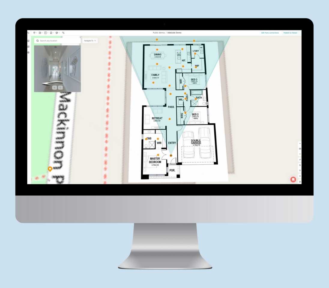
It's easier to understand a site when you can see the plan behind it.
Site & Floor Plans


Site Plan
Upload a site-wide layout to give your team a clear reference for large or complex areas.
Add a top-down layout to structure your map
Position data items directly on the plan
Supports .jpg and .png files

Floor Plan
Add floor-level layouts for rooms or multi-story buildings.
Upload one or more floors and layer them vertically
Easily switch between levels while viewing
Supports .jpg and .png files
How It Works

Upload
Upload your site or floor plan file and your plan will be added to the Project and appear over your base map.
Position
Use the built-in controls to rotate, scale and move the plan into place.
Assign data to a plan
Assign Photos, 360 Photos and other data items to a specific plan. Assigned items will only appear when that plan is visible.
Switch between plans
Use the Plan Toggle in the Viewer to explore different plans — your assigned data updates automatically to match.
FAQs
Can I upload more than one Site or Floor Plan?
Yes - you can upload multiple plans to the same Project and switch between them.
How do I switch between plans in the Viewer?
Use the Plan Toggle in the Map Controls (bottom-right corner of the Viewer) to switch between different Site and Floor Plans.
Can I control which data appears on each plan?
Yes - you have the option to assign any data item to a specific plan.
Do plans need to be georeferenced?
No - plans are placed manually on the map.
Can I stack multiple Floor Plans for a building?
Absolutely - you can add as many Floor Plans as needed and switch between them to navigate level by level.


